Tabaccomapp app for android description: Finally the high quality of the tabacco maps in digital.
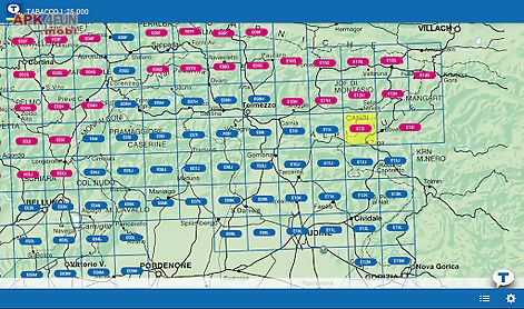
The application is free and you can buy the tabacco maps divided into modules map.
The application also allows you to share your trips on a community tabaccomapp community where you can review your trips in 3d!
Users: the application is suitable not only for hiking trekking and nordic walking enthusiasts but also for those who prefer mtb excursions or in winter snowshoeing or ski mountaineering.
Features: warning: continued use of gps running in the background can dramatically decrease battery life.
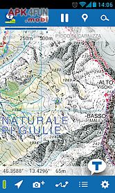
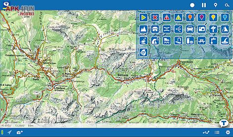
Quot zoom: the maps can be zoomed out for an overview or in to explore the terrain in minute detail.
You will appreciate the high quality of the digital maps!
Track record: via the gps incorporated in the device you can save your own excursions assigning a different color and a description to each one for instant recognition.
Signals: within the excursion you can identify various poi to which you can assign icons selected from the large number available (for example: parking place footpath interrupted old military station mountain pass etc.
).
Sharing: trails and waypoints are immediately available for sending by e mail by simply tapping an icon.
Import: it 39 s possible to export your own trail and just as easy to import one suggested by a friend and supplied in the form of a.
Gpx file complete with waypoints.
Photo: photos taken along the way will be saved and georeferenced for possible future use.
Ar+: using the augmented reality (ar+) facility when you look at the horizon with your device you will be able to recognize mountain peaks with their name and height mountain cols and passes mountain refuges bivouacs and locations based on a user defined kilometric distance scale.
Catalogue of maps how to buy them: from the application itself you can access a catalogue that provides images of maps already purchased of those available for purchase and of those that will shortly be av